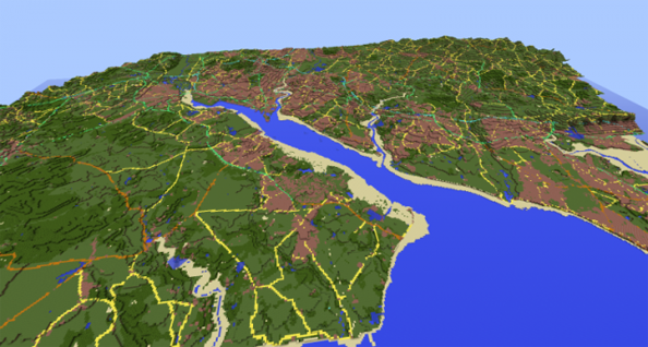
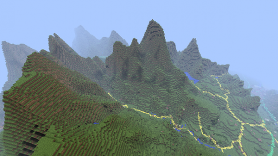
Ordnance Survey, the body responsible for mapping Great Britain from top to toe, have recreated 86,000 square miles of it in Minecraft. The map was built in two weeks by intern Joseph Braybrook and OS’s Innovation Labs team using the mapping authority’s OpenData products, and can be downloaded to explore for free.
Ordnance Survey’s data covers England, Scotland, Wales and their surrounding islands. The resulting Minecraft map incorporates 224,000 of Great Britain’s 229,848 square km.
“We think we may have created the largest Minecraft world ever built based on real-world data,” OS Innovation Lab Manager Graham Dunlop told the BBC.
“The resulting map shows the massive potential not just for using Minecraft for computer technology and geography purposes in schools, but also the huge scope of applications for OS OpenData too.”
Once downloaded, the map starts new players on the spot of OS’s head office in Southampton. From there, they can make mainland Britain – 22 billion blocks of it – their playground.

Using a combination of two programs – OS Terrain 50 and OS VectorMap – the mapping authority has managed to port a 3D model of the earth surface into the game, and overlay it with accurately placed bodies of water, woodland and roads. The entire generation process took about seven hours on a “modest” desktop PC.
OS have found equivalent materials for each of the key terrain types in their maps. Motorways are built in diamond, for instance, and B Roads from pumpkin.
“Each blocks represents a ground area of 50 square metres,” write OS. “The raw height data is stored in metres and must be scaled down to fit within the 256 block height limit in Minecraft. A maximum height of 2 500 metres was chosen, which means Ben Nevis, appears just over 128 blocks high.
“Although this exaggerates the real-world height, it preserves low-lying coastal features such as Bournemouth’s cliffs, adding interest to the landscape.”
Bloody hell, eh? You can find the map to download here – it’s approximately 3.6GB uncompressed. OS have also provided coordinates for some notable geographical landmarks, including Mount Snowdon, the site of London, and Lake Windermere.
